During at least the period of these diaries, Percy and his family lived at 560 Karl St. in Portland. Neither MapQuest nor Google Maps have any knowledge of a 'Karl St.' in Portland today. Thanks to Scott Daniels, a Reference Librarian at the Oregon Historical Society:
"In 1918, because of World War I, many German sounding street names were renamed in Portland. Karl Street became Haig Street, later SE Haig St and is in the Brooklyn neighborhood."
The Brooklyn neighborhood had received an influx of "largely Roman Catholic German-Americans" in the 1890's.
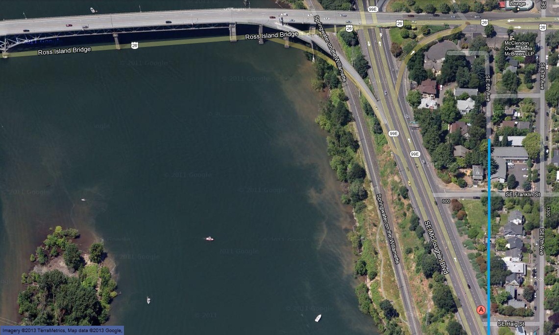
When I put '560 SE Haig St, Portland, OR', into Google Maps, the address is flagged in the middle of SE McLoughlin Blvd just west of its intersection with SE Haig St ('A' in the red circle, bottom right corner of the Google Map screen capture below). If the current SE 6th Ave. is extended to intersect Haig St (blue line on the image), the Google address marker is just west of 6th, consistent with the '560' street number. So, Percy's family was living in a house at or very near the top of the east-side bluff above the Willamette River at about the norther tip of Ross Island. The house was later razed for the contruction of McLoughlin Blvd.
Neither the Ross Island Bridge nor McLoughlin Boulevard existed until the mid 1920's.
| Copyright © 2013 Michael Barbour |